Hydrology
Land-based processes: modeling water and nutrient pollution across Panama
Project description
We create baseline layers to forecast water flow (and availability) and nutrient pollution using the
SWAT model,
calibrated for Panama, and validated using flow data. This will further be validated using nutrient data collected from our aquatic monitoring project.
Thus far, the model predicts 80% of the variation in observed water flow. This will serve as the foundation to answer diverse questions, such as the effect of climate change and land-use on water availability and pollution.
Additionally, we are building a statistical forecasting model that will be able to integrate this information on spatial patterning of rainfall to make better hydrological predictions given future scenarios.
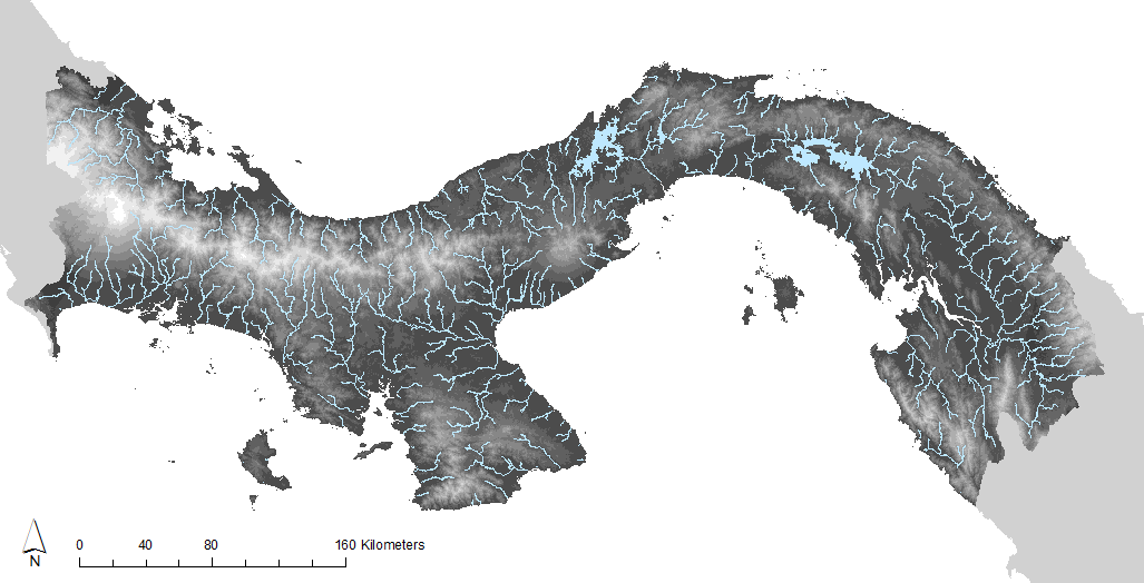
Figure: Water flow in Panama, as forecast by the SWAT model
PRISM project leader: Shriram Varadarajan
Publications: Varadarajan, S., Fábrega, J, Leung, B. 2022. Precipitation interpolation, autocorrelation, and predicting spatiotemporal variation in runoff in data sparse regions: Application to Panama. Journal of Hydrology: Regional Studies.
https://doi.org/10.1016/j.ejrh.2022.101252.